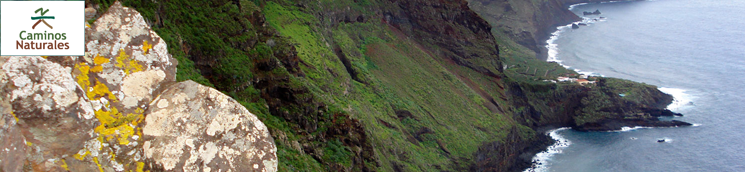
Nature Trails
Fuerteventura is the second largest island in the Canary archipelago and the whole island was named a
Biosphere Reserve by UNESCO on May 26, 2009.
The island has a wealth of natural protected areas -
comprising almost thirty per cent of its surface.
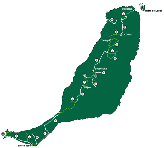
The island Council has laid out a series of Nature Trails, the trails go through the Natural Park of Islote de Lobos (Lobos Island); the Natural Monument of Malpaís de la Arena and their associated lava formations, which are residues of the last volcanic activity recorded on Fuerteventura; the “sacred” mountain of Tindaya, an iconic place for the “Majos” or aboriginals of the island; Betancuria Rural Park, the largest natural area of the island, with a landscape made of u-shaped cliffs; the Natural Monument Montaña Cardón; and finally, in the southern tip of the island, Jandía Natural Park, boasting all the habitats that can be found on the island: psammophilic or arenicolous areas (beach and sand habitats), salt marshes, rocky plains, cliffs, valleys and hills.
Biosphere Reserve by UNESCO on May 26, 2009.
The island has a wealth of natural protected areas -
comprising almost thirty per cent of its surface.
The island Council has laid out a series of Nature Trails, the trails go through the Natural Park of Islote de Lobos (Lobos Island); the Natural Monument of Malpaís de la Arena and their associated lava formations, which are residues of the last volcanic activity recorded on Fuerteventura; the “sacred” mountain of Tindaya, an iconic place for the “Majos” or aboriginals of the island; Betancuria Rural Park, the largest natural area of the island, with a landscape made of u-shaped cliffs; the Natural Monument Montaña Cardón; and finally, in the southern tip of the island, Jandía Natural Park, boasting all the habitats that can be found on the island: psammophilic or arenicolous areas (beach and sand habitats), salt marshes, rocky plains, cliffs, valleys and hills.
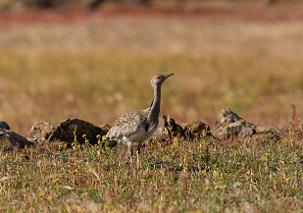
The island is also home to a large number of birds, many
of them migratory, such as the Canary Islands houbara bustard
(Chlamydotis undulata fuertaventurae), the Cory’s Shearwater
(Calonectris diomedea), the guirre or Fuerteventura vulture (Neoprhron
percnopterus majorensis) or the aguililla or Canary Island common
buzzard (Buteo buteo insulrum).
Along
the Nature Trail you will become acquainted with the history of
Fuerteventura, its aboriginal culture before the Norman conquest and its
manorial past, as well as the different traditional cultivation systems
used by the inhabitants of the island (Majoreros) to counteract the
hostility of the terrain and the lack of water in order to carry out
their agricultural activities.
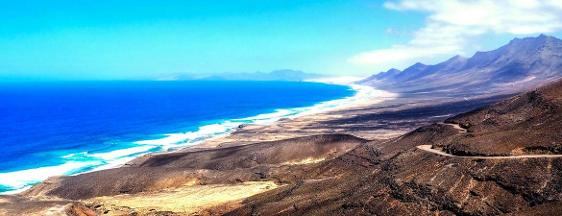
The Jandia Peninsular Trail
In spite of the lack of vegetation cover, you can see on
the way numerous endemic plant species, particularly Jandía cactus
(Euphorbia handiensis), as well as palms and tamarisks in the beds of
ravines and valleys.
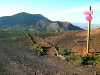
If you enjoy hiking you will find plenty of easy routes to explore and get to see another perspective of the island.
All of the following are recognised and recommended by the Island Council and some of the paths are signposted.
Lajares-Corralejo
This route will take you around 3-4 hours.
The route starts in Lajares, if traveling by bus then ask the driver for “el campo de futbul” (football pitch). then you should take the signposted road to the “Calderon Hondo” volcano crater (which is just off the Majanicho road.) This will take you into the volcanic area known as Mascona. There are wonderful views towards Lajares and the southern part of the island along this stretch of the route. Calderon Hondo is a circular volcanic cone around 70 meters deep, The “Caldera Encantada” (enchanted crater) is worth visiting before continuing through the Morro del Fraile (Friar’s Hill)to Corralejo.
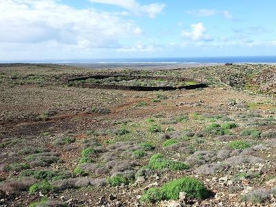
Malpais de La Arena
This route, which will take you about 3 hours, starts close to Villaverde. Malpais means badlands and is generally given to land that has been covered with volcanic rocks from past eruptions. Arena means sand so in this case it probably earned the name “badlands” as it was most unsuitable for farming. The stretch from Montana del Molino to the Montana de los Saltos runs along the walls that separate El Malpais de la Arena from the farming land around Villaverde. From La Hoya del Agua you will enjoy a magnificent view over the northern area of the island. The lava outflows from the Villaverde volcanoes and those that make up Malpais de la Arena can be made out. From the base of the Montana de la Arena (Mountain of the Sand) you will be able to look across the north of the island and towards the Isla de Lobos and Lanzarote.
Barranco de la Herradura.
This route starts just outside of Puerto Del Rosario at the mouth of the ravine that runs to Time. As you go along this route you will be able to see, apart from the flora and fauna, the ruins of early settlements. Allow about 3 hours for the easy hike.
Barranco de Los Molinos.
Another easy route that will take 2-3 hours, you can start at the Alcogida Eco Museum (or find the wide, deep. ravine 4km from Tefia) follow the ravine (or barranco) to the sea, you will see plenty of examples of the islands flora and fauna.
Caleta de Fuste-Salinas del Carmen.
The path starts from the beach of Caleta de Fuste where you can first visit the fortified castle, then walk south along the shore past the La Guirra lime kilns. This path used to be part of the road that joined Puerto del Rosario and Antigua, you will be able to visit the islands only remaining salt flats. Next there is a tiny fishing village where you can stop for refreshment before continuing south to the ravine known as Barranco de la Torre. The easy hike will take approx. 2 hours.
All of the following are recognised and recommended by the Island Council and some of the paths are signposted.
This route will take you around 3-4 hours.
The route starts in Lajares, if traveling by bus then ask the driver for “el campo de futbul” (football pitch). then you should take the signposted road to the “Calderon Hondo” volcano crater (which is just off the Majanicho road.) This will take you into the volcanic area known as Mascona. There are wonderful views towards Lajares and the southern part of the island along this stretch of the route. Calderon Hondo is a circular volcanic cone around 70 meters deep, The “Caldera Encantada” (enchanted crater) is worth visiting before continuing through the Morro del Fraile (Friar’s Hill)to Corralejo.
Malpais de La Arena
This route, which will take you about 3 hours, starts close to Villaverde. Malpais means badlands and is generally given to land that has been covered with volcanic rocks from past eruptions. Arena means sand so in this case it probably earned the name “badlands” as it was most unsuitable for farming. The stretch from Montana del Molino to the Montana de los Saltos runs along the walls that separate El Malpais de la Arena from the farming land around Villaverde. From La Hoya del Agua you will enjoy a magnificent view over the northern area of the island. The lava outflows from the Villaverde volcanoes and those that make up Malpais de la Arena can be made out. From the base of the Montana de la Arena (Mountain of the Sand) you will be able to look across the north of the island and towards the Isla de Lobos and Lanzarote.
Barranco de la Herradura.
This route starts just outside of Puerto Del Rosario at the mouth of the ravine that runs to Time. As you go along this route you will be able to see, apart from the flora and fauna, the ruins of early settlements. Allow about 3 hours for the easy hike.
Barranco de Los Molinos.
Another easy route that will take 2-3 hours, you can start at the Alcogida Eco Museum (or find the wide, deep. ravine 4km from Tefia) follow the ravine (or barranco) to the sea, you will see plenty of examples of the islands flora and fauna.
Caleta de Fuste-Salinas del Carmen.
The path starts from the beach of Caleta de Fuste where you can first visit the fortified castle, then walk south along the shore past the La Guirra lime kilns. This path used to be part of the road that joined Puerto del Rosario and Antigua, you will be able to visit the islands only remaining salt flats. Next there is a tiny fishing village where you can stop for refreshment before continuing south to the ravine known as Barranco de la Torre. The easy hike will take approx. 2 hours.
For maps and comprehensive information about the Islands Nature Trails please follow this link